|
Biodiversity Information Science and Standards : Conference Abstract
|
|
Corresponding author: Tania Urquiza-Haas (turquiza@conabio.gob.mx)
Received: 11 Jul 2019 | Published: 17 Jul 2019
© 2019 Oscar Godínez-Gómez, Angela Cuervo-Robayo, Diana Ramírez-Mejía, Wolke Tobón, Jesús Alarcón, Patricia Koleff, Tania Urquiza-Haas
This is an open access article distributed under the terms of the Creative Commons Attribution License (CC BY 4.0), which permits unrestricted use, distribution, and reproduction in any medium, provided the original author and source are credited.
Citation: Godínez-Gómez O, Cuervo-Robayo AP, Ramírez-Mejía D, Tobón W, Alarcón J, Koleff P, Urquiza-Haas T (2019) Planning Landscape Connectivity in Mexico under Global Change. Biodiversity Information Science and Standards 3: e38199. https://doi.org/10.3897/biss.3.38199
|
|
Abstract
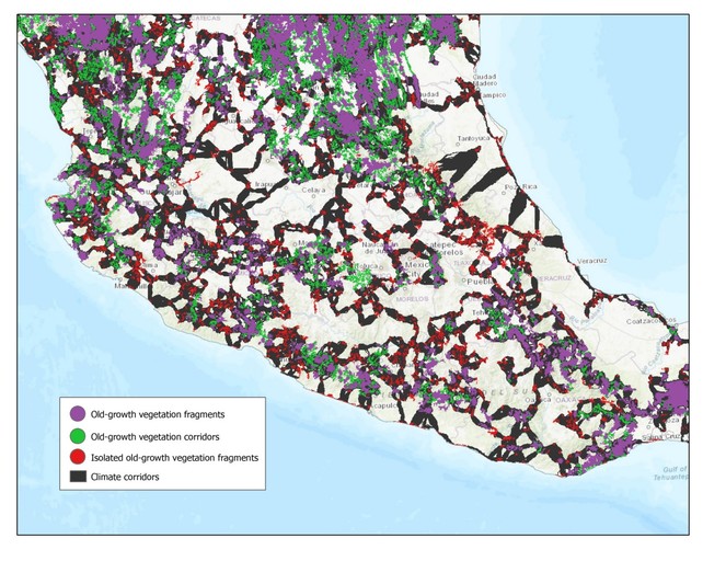
Climate change, habitat loss and fragmentation, invasive species, and resource over-exploitation are among the major factors driving biodiversity loss and the current global change crisis. Maintaining and restoring connectivity throughout fragmented landscapes is key to reduce habitat isolation and mitigate anthropogenic impacts. To date, few connectivity approaches seek to identify corridors along climate gradients and least transformed natural habitats despite its importance to facilitate dispersal of organisms, as species' ranges shift over time to track suitable climates. In this study, we identified least-cost climatic corridors in Mexico between 2027 old-growth vegetation patches incorporating evapotranspiration as climatic variable, Euclidean distances, and human impact. We identified old-growth vegetation patches using the land use and vegetation map of 2011 (scale 1:250 000) by the National Institute of Statistics and Geography (INEGI). Moreover, we calculated a human impact index based on the theoretical framework of the Global Biodiversity Model (
Keywords
climate change, landscape connectivity, guide spatial allocation of conservation resources
Presenting author
Patricia Koleff
Presented at
Biodiversity_Next 2019
References
-
GLOBIO3: A framework to investigate options for reducing global terrestrial biodiversity loss.Ecosystems12(3):374‑390. https://doi.org/10.1007/s10021-009-9229-5
-
One hundred years of climate change in Mexico.PLOS One.
-
Indicadores de impacto humano, herramienta para evaluar el estado de conservación de la biodiversidad. In: CONABIOCapital natural de México, Vol. IV. Capacidades humanas e institucionales.CONABIO,Mexico,337-340pp.
-
The water balance of soils:Relation between precipitation, evaporation and flow.Annales Agronomiques5:491‑569.
Downloaded from http://atlasclimatico.unam.mx:8550/geonetwork/srv/spa/main.home at a spatial resolution of 30" X 30"
