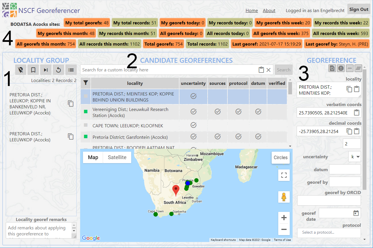
The user interface for the georeferencing tool, showing:
- a group of similar localities to be georeferenced,
- possible matching georeferences based on fuzzy string matching,
- locality, coordinates, and metadata fields for a selected georeference or for creating a new georeference to use for the localities in 1, and
- realtime statistics for the current dataset.