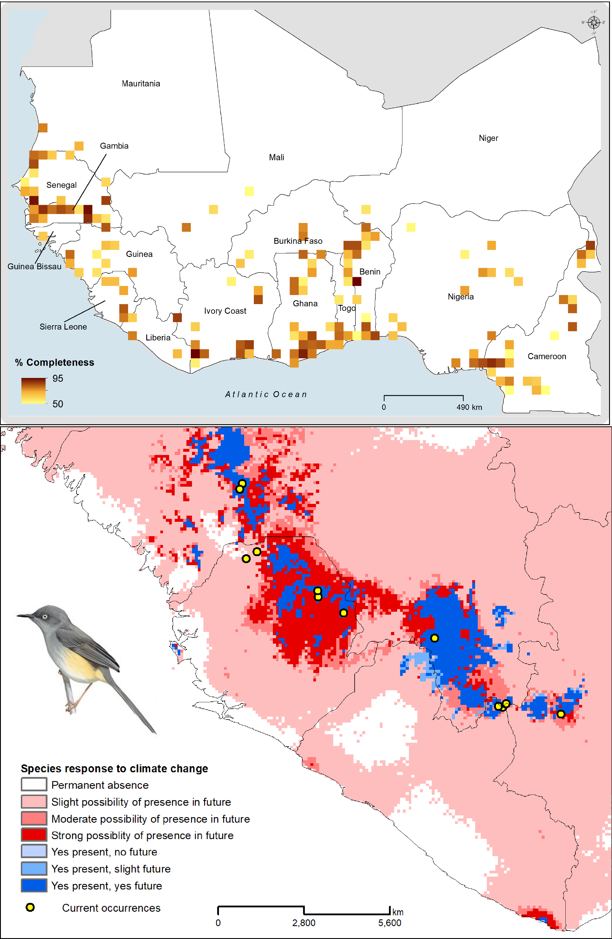
Maps showing summary results from survey completeness and gap analyses at 0.5° spatial resolution (top) and an example result from the distributional analysis (bottom) for an endemic West African bird species for present and future climate projections.