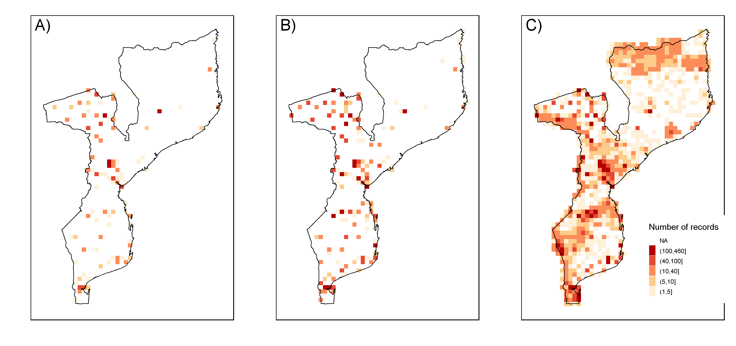
Mapping the knowledge gain while compiling primary species occurrence data regarding terrestrial mammals reported for Mozambique. Spatial visualisation of A) ready-to-use digitally accessible data from online resources and natural history collections; B) digital data available after quality updates, namely after georeferencing and taxonomic verification; and C) data available after digitisation of grey and scientific literature.